About Cubert Common walk, North Cornwall
Named walking route from OpenStreetMap (foot).
Along the way there are 36 places worth knowing about — somewhere to eat, things to see, and family stops close to the route. Scroll down for the map and the full list.
Walk map & stop-offs
Orange lines are the trails. Coloured pins are places near the walk — tap any pin (or the buttons below) for cafés, sights, family stops and more.
Stops along the way
Real places near this walk — pulled from the Cornish.co.uk directory. Somewhere to eat, things to see, family days out, wildlife and beaches within easy reach.
Eat & drink
 0.9 km
Eat
The C Bay Bar & Restaurant
Experience stunning coastal views and exquisite dining at The C Bay, a sophisticated restaurant near Crantock.…
0.9 km
Eat
C-Bay Cafe Bar & Bistro
Situated at the West Pentire headland, this vibrant cafe offers stunning panoramic sea views. Enjoy fresh,…
0.9 km
Eat
The C Bay Bar & Restaurant
Experience stunning coastal views and exquisite dining at The C Bay, a sophisticated restaurant near Crantock.…
0.9 km
Eat
C-Bay Cafe Bar & Bistro
Situated at the West Pentire headland, this vibrant cafe offers stunning panoramic sea views. Enjoy fresh,…
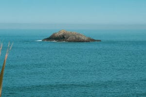 1 km
Eat
The Bowgie Inn
A legendary pub nestled above Crantock Bay, offering breathtaking sea views and a warm, traditional atmosphere.…
1.3 km
Eat
The Lanyon Inn
A welcoming gastropub near Colan, serving delicious food and drinks in a relaxed atmosphere. Perfect for…
1.8 km
Eat
Fern Pit Cafe
A charming seaside cafe with spectacular views overlooking Holywell Bay, just a short distance from West…
1 km
Eat
The Bowgie Inn
A legendary pub nestled above Crantock Bay, offering breathtaking sea views and a warm, traditional atmosphere.…
1.3 km
Eat
The Lanyon Inn
A welcoming gastropub near Colan, serving delicious food and drinks in a relaxed atmosphere. Perfect for…
1.8 km
Eat
Fern Pit Cafe
A charming seaside cafe with spectacular views overlooking Holywell Bay, just a short distance from West…
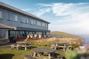 1.8 km
Eat
Lewinnick Lodge
Perched on a dramatic clifftop, Lewinnick Lodge offers an unforgettable dining experience with breathtaking panoramic sea…
1.8 km
Eat
Lewinnick Lodge
Perched on a dramatic clifftop, Lewinnick Lodge offers an unforgettable dining experience with breathtaking panoramic sea…
See & do
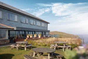 1.8 km
See
Lewinnick Cove
Dramatic cliffside views and a superb restaurant with a terrace overlooking the sea. Perfect for a…
1.8 km
See
Newquay View Inn (for food/drinks)
A popular spot offering classic pub fare and local ales with a family-friendly atmosphere. A good…
1.8 km
See
Lewinnick Cove
Dramatic cliffside views and a superb restaurant with a terrace overlooking the sea. Perfect for a…
1.8 km
See
Newquay View Inn (for food/drinks)
A popular spot offering classic pub fare and local ales with a family-friendly atmosphere. A good…
 1.9 km
See
Cornwall Coast Path (Newquay Section)
Wander along breathtaking cliff-top trails offering panoramic sea views, hidden coves, and abundant wildlife. Accessible for…
2.8 km
See
The Gannel Estuary
A stunning natural estuary offering scenic walks, birdwatching opportunities, and peaceful riverside paths. Kayaking and paddleboarding…
1.9 km
See
Cornwall Coast Path (Newquay Section)
Wander along breathtaking cliff-top trails offering panoramic sea views, hidden coves, and abundant wildlife. Accessible for…
2.8 km
See
The Gannel Estuary
A stunning natural estuary offering scenic walks, birdwatching opportunities, and peaceful riverside paths. Kayaking and paddleboarding…
 2.8 km
See
Penpol Creek (Gannel Estuary)
A beautiful beach near Crantock, Cornwall.
3.1 km
See
St Cubert's Church
Explore the serene and historic St. Cubert's Church, a beautiful place of worship with a rich…
2.8 km
See
Penpol Creek (Gannel Estuary)
A beautiful beach near Crantock, Cornwall.
3.1 km
See
St Cubert's Church
Explore the serene and historic St. Cubert's Church, a beautiful place of worship with a rich…
Family & play
4 km
Family
Trenance Leisure Park
A fantastic family fun zone offering boating on the lake, adventure golf, a playground, and open…
4.3 km
Family
Newquay Trampoline Park
Bounce, flip, and have a blast at this indoor trampoline park, offering endless fun for active…
5.9 km
Family
Perran Sands Holiday Park (Surf School)
Get your adrenaline pumping with a surfing lesson at Perran Sands Holiday Park, just a stone's…
Wildlife & nature
3.6 km
Wildlife
Blue Reef Aquarium
Discover amazing marine life from local waters and exotic oceans. Witness thrilling shark feeds and explore…
3.6 km
Wildlife
Blue Reef Aquarium Newquay
Dive into the wonders of the ocean at Blue Reef Aquarium Newquay. Discover fascinating marine life…
4.4 km
Wildlife
Newquay Zoo
A fantastic family day out with a diverse range of animals from around the world. Educational,…
Beaches nearby
 2.7 km
Beaches
Fistral Beach
Tucked away beside the main Fistral, this smaller cove near West Pentire is a delightful spot…
2.7 km
Beaches
Fistral Beach
Tucked away beside the main Fistral, this smaller cove near West Pentire is a delightful spot…
Shops & markets
0.4 km
Shop
The Stable Tea Rooms & Gift Shop
Nestled near Crantock, enjoy delicious Cornish treats and browse a curated selection of handcrafted gifts and…
1.3 km
Shop
The Cornish Duck
Experience authentic Cornish produce and unique gifts at The Cornish Duck, a delightful independent shop near…
1.3 km
Shop
Crantock Store
Your local hub for daily essentials and a touch of Cornish charm, right in the heart…
1.5 km
Shop
C-Bay Beach Shop
Discover beachwear, gifts, and local crafts at this delightful shop just a stone's throw from Crantock…
3.2 km
Shop
Little Bo-Peep Children's Wear
Adorable and thoughtfully curated children’s clothing and gifts. A charming boutique offering unique styles for little…
3.3 km
Shop
The Oyster Box (Shop/Deli)
While primarily a restaurant, their attached shop/deli often features local artisan produce, chutneys, jams, and Cornish…
Places to stay
1.4 km
Stay
The Tregenna
A charming, family-run guest house offering a warm Cornish welcome near Summercourt. Enjoy comfortable rooms and…
1.4 km
Stay
The Old Rectory
Experience elegant country living near Treworthal. This charming B&B offers peaceful rooms and a delightful garden,…
1.4 km
Stay
Seaview Guesthouse
Enjoy stunning coastal views from this delightful guesthouse, just a short stroll from Criggan. Offers comfortable…
1.9 km
Stay
The Trevethan Arms
A characterful inn offering comfortable rooms and a warm welcome near the stunning Holywell Bay. Enjoy…
1.9 km
Stay
Little Hendra Farm
Discover rustic charm at Little Hendra Farm, offering a unique glamping experience just a stone's throw…
 2.1 km
Stay
Carn Melyn Bed and Breakfast
A welcoming B&B offering comfortable accommodation with a friendly atmosphere, ideally situated for exploring Crantock village…
2.1 km
Stay
Carn Melyn Bed and Breakfast
A welcoming B&B offering comfortable accommodation with a friendly atmosphere, ideally situated for exploring Crantock village…
Know before you go
🧭 Getting there
The walk starts near Newquay. Use the directions button above to route to the trailhead.
🅿️ Parking
Check locally for the nearest car park — many Cornish trailheads have limited roadside parking.
🐕 Dogs
Dogs are generally welcome on Cornish trails — keep them on a lead near livestock and cliff edges.
⛰️ Safety
Paths can be muddy and uneven after rain. Wear suitable footwear and let someone know your route on longer walks.