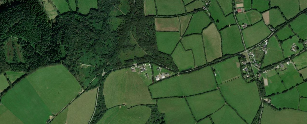
Forestry England woodland near Bodmin with five waymarked walking trails — from a flat riverside pushchair loop to longer climbs with valley views. All start from the main pay-and-display car park.
About Cardinham Woods
Waymarked trails at Cardinham Woods
Pick a trail by name — distance, time, hills and surface for each waymarked circuit. All start from the main car park. Official walking map (PDF) ↗
Lady Vale Walk
EasyThe favourite family route — follow Cardinham Water upstream to Lady Vale Bridge under dappled shade. Gruffalo sculptures on this trail.
- Distance2.75 km (1.7 miles) · shortcut 1.45 km
- Time45–60 min
- TerrainFully surfaced · wide · mostly flat
- HillsOne short gentle slope on the return (avoid via Centenary Bridge)
- Water / crossingsRiverside throughout · several dog-dip spots · no road crossings
- AccessPushchair & wheelchair friendly · Tramper suitable · benches along the way
Callywith Wood Walk
Easy–moderatePleasant stream then a gradual climb to a valley viewpoint — great for autumn colour.
- Distance4.3 km (2.7 miles)
- Time1–1½ hours
- TerrainForest tracks · well surfaced
- HillsGradual climb past older conifers · steady descent back
- Water / crossingsFollows a stream then climbs the valley side · no fords
- AccessTramper suitable · viewpoint halfway round
Lidcutt Loop
ModerateAlong Lady Vale to the bridge, then uphill to the Scots pine picnic spot and views before dropping back.
- Distance4.8 km (3 miles)
- Time1¼–1¾ hours
- TerrainSmooth and loose surfaces mixed
- HillsModerate slopes up to the Scots pine picnic area
- Water / crossingsShares Lady Vale riverside then climbs · no river fords
- AccessTramper suitable · seating halfway
Wheal Glynn Walk
Moderate–hardSteeper loop to the ruins of Wheal Glynn Mine (silver & lead until 1859), then zig-zag back to the riverside.
- Distance4.6 km (2.8 miles)
- Time1½–2 hours
- TerrainForest paths · steeper sections
- HillsSteep climb to the old silver/lead mine · zig-zag descent
- Water / crossingsSplits from Lady Vale · no water crossings on the climb
- AccessNot Tramper suitable · look for engine house & chimney through the trees
Deviock Trail
ModerateLongest trail — gentle climb to the forest edge for views, wildlife and spring bluebells, returning via the Scots pine picnic area.
- Distance7 km (4.3 miles) · shortcut 5.8 km
- Time2–2½ hours
- TerrainTracks · some uneven / loose sections
- HillsGentle climb to the outer forest edge · best chance of deer
- Water / crossingsForest tracks · no major fords
- AccessNot Tramper suitable · bluebells in May
Forest paths & stop-offs
Orange lines show the forest path network for context. Numbered markers are the waymarked walks — tap one (or use Show on map above) for distance, time and hills. Coloured pins are cafés and places nearby.
Stops along the way
Real places near this walk — pulled from the Cornish.co.uk directory. Somewhere to eat, things to see, family days out, wildlife and beaches within easy reach.
Eat & drink
2.2 km
Eat
The Snail's Pace Cafe (Cardinham Woods)
Tucked away in the beautiful Cardinham Woods, this popular cafe is a haven for cyclists, walkers,…
See & do
0.1 km
See
Cardinham Woods
Discover the enchanting Cardinham Woods, ideal for families and outdoor enthusiasts near Ruthernbridge. Enjoy scenic walking…
0.7 km
See
Cardinham Woods
Explore ancient woodlands near Cardinham with stunning walking and cycling trails. Perfect for families and nature…
1 km
See
Cardinham Woods
Escape to nature at Cardinham Woods, a stunning woodland haven close to Milltown. Enjoy walking, cycling…
Family & play
Wildlife & nature
Shops & markets
3.1 km
Shop
Callywith College - Art & Design Shop (if open to public retail)
Explore student-created art and craft pieces from the local Callywith College, offering a unique opportunity to…
Places to stay
1.3 km
Stay
Tredethy House
Experience exquisite Georgian elegance at Tredethy House itself, a stunning boutique hotel nestled just moments from…
2.1 km
Stay
The Lodge at Cardinham Woods
While not a traditional hotel, this unique lodge offers a rustic and immersive woodland experience. Perfect…
Know before you go
🧭 Getting there
The walk starts near Bodmin. Use the directions button above to route to the trailhead.
🅿️ Parking
Forestry England main car park (P&D) · PL30 4AL
🐕 Dogs
Welcome · keep in sight · water & dog wash by toilets · farmland borders the woods
💡 Tips
Download the Forestry England walking map before you go. Trails are waymarked from the car park. Mobility scooter (Tramper) hire available for Lady Vale, Callywith and Lidcutt — pre-book. Café on site.
📈 Hills & gradients
Lady Vale is nearly flat; Lidcutt, Callywith & Deviock have gradual climbs; Wheal Glynn has steep zig-zags
⛰️ Safety
Paths can be muddy and uneven after rain. Wear suitable footwear and let someone know your route on longer walks.